The twenty mile passage from Isla Coronados to Caleta San Juanico was a special one with the spinnaker up the whole way! The wind was light, around eight knots, and from the right direction. Seas were flat so Solera made good progress at around five knots. Always looking for more speed I remembered seeing an old picture of a Columbia 40 flying it’s spinnaker. It had what’s called a spinnaker staysail up. So, I decided to raise our staysail and see what happened. At the wind angle we had it set well and did not affect the spinnaker much at all. Adding the staysail bumped up our speed by half a knot.
As we approached San Juanico it was time to douse the spinnaker. (This is probably boring to most of you but I just love this stuff.) Our setup has a sock that gets pulled down and in the process gathers the giant fifty foot tall sail into a long fabric tube. After that you lower the tube to the deck with the halyard. That all sounds great but it’s important to get the snuffing done quickly. Lines tangle, sails tear, or end up in the water when things go wrong. So, Cyn and I tried something different this time to make things more efficient. We put the boat on autopilot and both of us went to the foredeck. She went to the bow and I stayed by the mast with the line for the sock. When we were both ready, Cyn pulled the lanyard on the snap-shackle at the bow. The sail released with a pop and went flying away from the boat. At the same instant I began drawing the sock down snuffing the sail. I bet it took less than ten seconds to get the huge spinnaker doused!

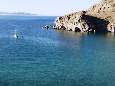
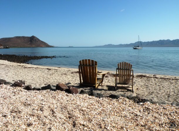
At San Juanico we were lucky and got the best spot in the bay to anchor. There is only room for one sailboat between the detached ridge of rock spires and another block shaped island at the north end of the bay. We moved in right after a trawler left. San Juanico gets a fair amount of swell so anchoring between the rocks offers great protection. Plus, it’s really cool being tucked in between the beautiful formations.


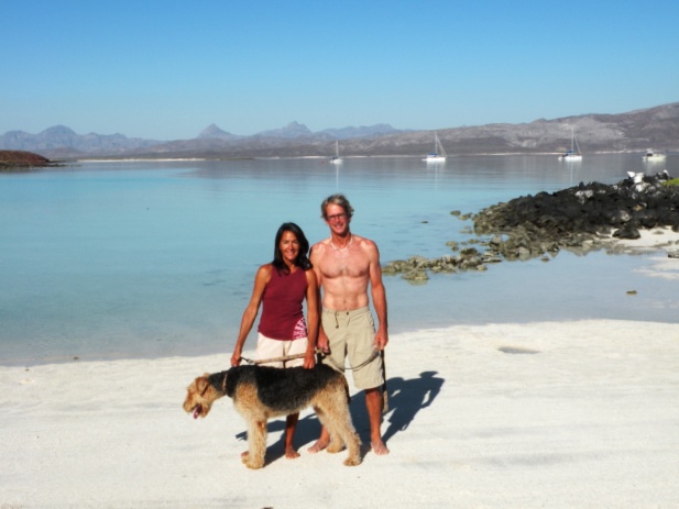
Our cruisers guide said there are black obsidian apache tears “dotting the seven mile dirt road that connects San Juanico to Highway 1“. Cindy and I went out on a mission to find them. We took a five mile morning hike and found nothing but heat and a broken down water truck. Not a single apache tear anywhere. I was ready to give up but we knew these rocks were around somewhere. At the cruiser’s shrine the trawler Pacific left his boat name spelled out in apache tears. Turned out, a short hike that evening over the hill behind the shrine led us to a different section of the dirt road. It really was dotted with the black glass stones. Cyn and I both picked up a handful.

Our next passage was a long one, fifty three miles up to Playa Santispac in Bahia Concepcion. We left in a stiff breeze with the first reef in. Solera shot across the eight mile Bahia San Basilio in just over an hour. Then the fun was over. The wind shifted behind us and dropped to about five knots. We had to motor sail the rest of the way to make it to our planned anchorage before dark. I guess we’re cruisers and not sailing purists. I can understand why some sailors keep their engines off as much as possible or, don’t have one at all. It would be very satisfying to complete a passage anchor up to anchor down under sail only. But, a flexible schedule and a willingness to wait for wind would be a must.

At Santispac we were greeted by another whale shark as we set the anchor. This one circled around but never came closer than about twenty yards. Looked like it might be a little bigger the one at Escondido. This time in Concepcion we wanted to check out some new anchorages. We sailed down to Isla Requeson and found a nice beach and at nearby Playa Buenaventura a great restaurant bar. We also anchored at Playa Coyote for a night. The water temp has warmed considerably since our last stay in the bay. With the south trending winds, the air temp and humidity were also up. All signs that it’s time to head back to San Carlos.

Our plan was to leave Concepcion and anchor at Punta Chivato about twenty miles up the coast. The idea being to shave a few miles off the upcoming sail back across the sea. This ended up being a poor decision. I knew the Chivato anchorage offered marginal protection and sure enough when we arrived the conditions were too rough. Plan B took us to the other side of the point to an alternate anchorage. Once again, too rough. This left us with a choice of backtracking twenty two miles or continuing twenty two miles to an anchorage on the north side of Isla San Marcos. We chose San Marcos hoping for the best and arrived at dusk to a beautiful protected little cove. The bad part was we sailed about forty five miles and only took five miles off the crossing distance.

Then came our next bad choice. The SSB weather called for ten to fifteen “all night long” for the seventy three mile crossing that evening. Those would be pretty good conditions. We decided to go for it leaving at 1600 that afternoon. Things ended up being quite different. Rounding the north end of San Marcos put us in high winds and rough seas that stayed with us pretty much all the way across. These were the roughest conditions I’ve experienced on a sailboat. Occasional waves into the cockpit, water running down the side decks, and lots of motion. Cyn said it was like an amusement park ride (she hates amusement park rides). Just as things really got interesting I thought “I should put on my foul weather jacket”. Not more than a minute later a large wave climbed up the side of the hull and broke into the cockpit. I got doused and immediately went for the foulies. Cyn and I were glad to be on a boat the size of Solera in those conditions. We sailed under a double reefed main and staysail but still had a fast crossing at thirteen hours.
Dolphins visited a half dozen times that moonless night. I never saw one though. All I could see were the phosphorescent trails they were leaving. It was unreal watching the large tubes of underwater sparks quickly converging on the boat in formation. The trails were often thirty feet long. It looked like a volley of fast torpedoes headed for Solera.
We arrived in San Carlos at first light. Entering the calm bay, we dropped sail then motored past our mooring and tied up at the empty fuel dock. What a nice feeling it was to finally relax after the challenging all night passage. I got a funny look from Cindy when I grabbed a beer at five in the morning. Sure tasted great. We never had any alcohol while sailing, only when safely at anchor or in a marina. Conditions quickly change out there and good judgment is a must.
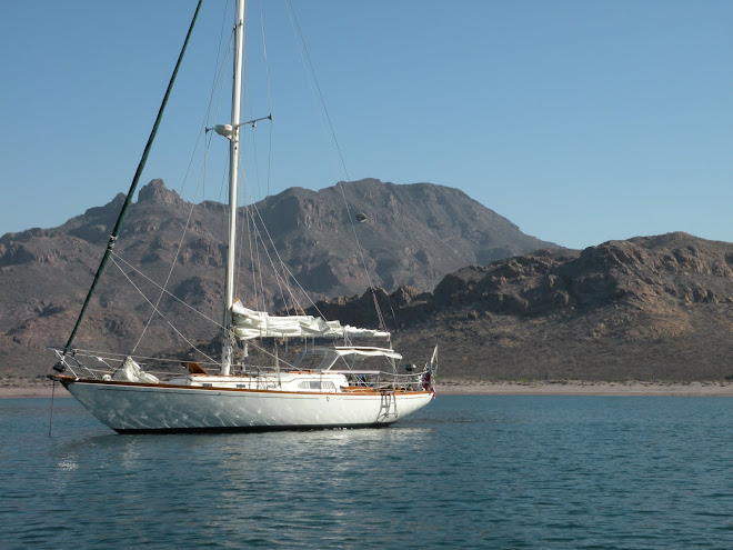
This whole Baja cruise has been an incredible adventure. We logged just under five hundred miles and stayed in fourteen different anchorages. Each one had it’s own unique character. The sailing conditions were fantastic until the very last day. Solera was a comfortable floating home with all the necessities and a few luxuries. She proved to be a safe and sturdy boat with great sailing characteristics. Everyone we met, both Gringos and Mexicans, were pleasant and friendly. Most of the cruisers we talked to go out for several months at a time and a few were out there full time. For now Cyn and I will come down in the Spring and in the Fall spending a couple of months on each trip. There are many more areas in the Sea of Cortez we plan to explore. We’ll be back again in October 2010!